
Walk a St. George Address Trail
Start with the exact street string, direction, suffix, unit, city, state, and ZIP. Address data can vary at a corner parcel, duplex, alley, or city-limit edge. USPS supplies the current delivery result. County and city maps then turn that string into a parcel, subdivision, or feature. The assessor can add a property report, while the Recorder provides the legal instrument behind an ownership change. A historical telephone book may supply an older subscriber, but it cannot fill in every household member.
- Enter the full address in USPS ZIP Code Lookup and save the ZIP or ZIP+4 response.
- Run the address in the Washington County parcel viewer and note account, parcel, subdivision, and ownership labels.
- Open St. George PowerMobile, search the address, and identify the parcel or city feature.
- Use the parcel or owner lead in the Recorder index, then follow the latest grantee to the prior grantor.
- Compare a public voter address or historical source only when that record’s purpose fits the question.
St. George Parcel Search
The Washington County GIS Quick Start screen uses a required “Search for a Parcel By” method. Select Account Number, Parcel ID Number, or Address, then choose Continue. With parcel ID, initial characters filter a list before the parcel is selected. The map highlights the selected land and displays attributes. The guide identifies Account Number, Parcel Number, Subdivision Name, and Ownership as result fields.
| Control | Type and purpose |
|---|---|
| Search for a Parcel By | Required dropdown with Account Number, Parcel ID Number, or Address. |
| Parcel # | Text or autocomplete; starting characters filter choices. |
| Continue | Advances to the chosen parcel method. |
| Cancel | Leaves the parcel method without selecting it. |
| Account Number / Parcel Number | Result identifiers for linking map and property research. |
| Subdivision Name / Ownership | Result context, with exact live presentation subject to viewer changes. |
The county map inventory also lists parcel, Recorder’s Office, Assessor Record Search, Community Development, Election Map, aerial, Old Abstract, and ownership-plat viewers. A free map is an orientation tool. County GIS says owner name and mailing address are maintained separately and can be purchased through a Public Extract or Assessment Roll.
St. George Street GIS Layers
County GIS layers include parcels, subdivisions, street centerlines, contours, streams, city limits, flood zones, and zoning. These layers answer where a parcel sits and what boundaries surround it. St. George PowerMobile accepts a global search for an address, street name, subdivision, or tax ID, then offers parcel-identify and feature-identify tools. The city ArcGIS Places service adds public facilities and neighborhood or subdivision labels such as Bloomington Hills, Little Valley, Sunbrook, and Tonaquint.
A label is not a legal association roster. “Adjacent” means parcels touch in the map layer; it does not mean they share a postal route or civic group. For a block question, note the scale and layer used. For a title question, leave the map and read the Recorder instrument. The street directory works best when map context and legal records are treated as connected but separate evidence.
The Washington County GIS inventory is the official launch point for parcel and map viewers.
Keep a screenshot date with a map result. Current layer vintages and refresh schedules were not published in the research record.
St. George Property Records
The Assessor is the property-report starting point. Washington County describes valuation, property reports, images, sketches, tax tools, and appeal information. Real property is appraised at 100 percent of market value as of January 1 each year, with a notice mailed at the end of July. The Assessor is not the office for legal descriptions, recorded ownership transfers, or plats.
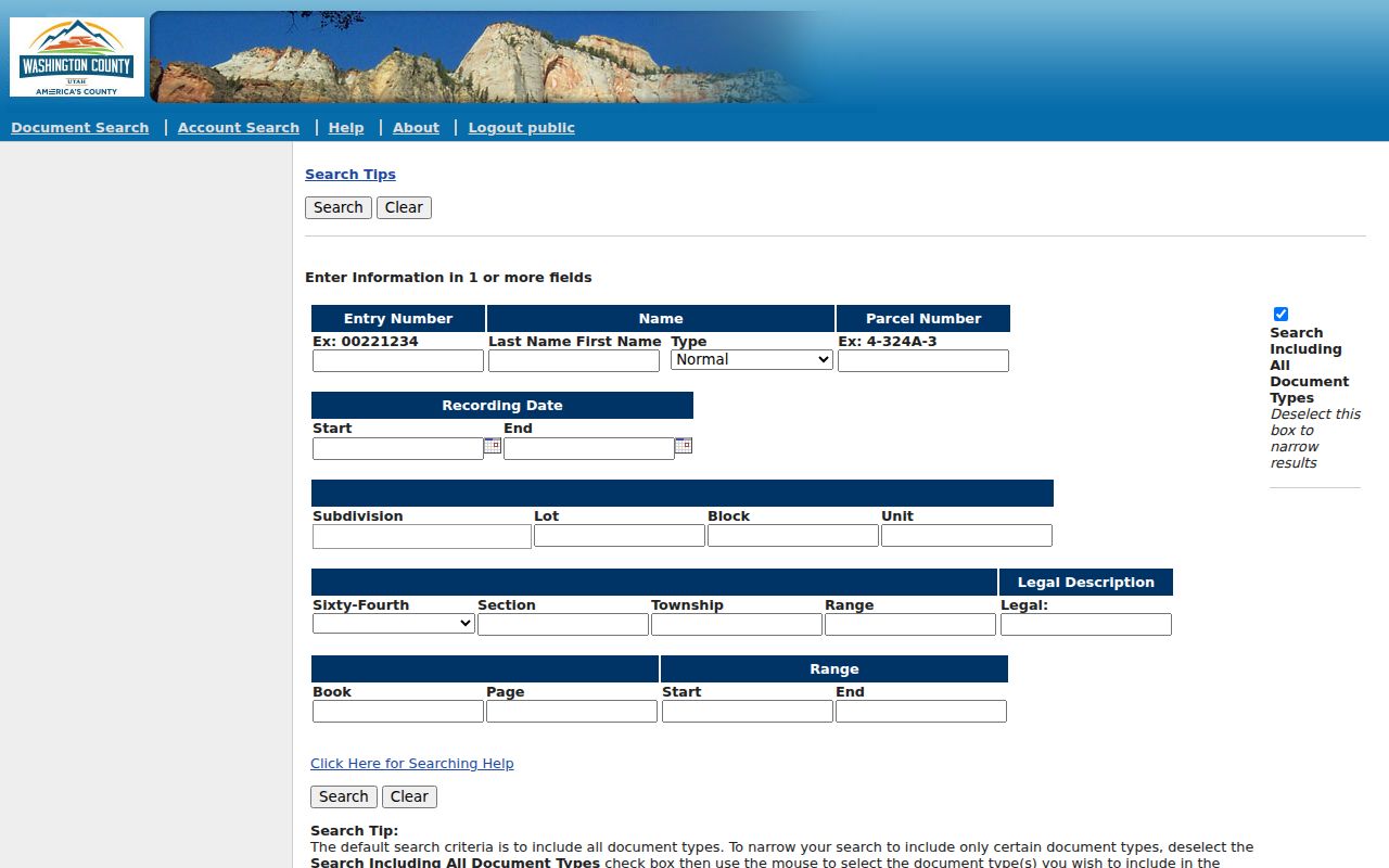
The Recorder is that legal-record starting point. Its page links Property Search, Property Watch, Interactive Map, Surveyor, Historical Documents, and standards. The public Property Search link currently reaches a dynamic guest-login endpoint, and the online cutoff for images and index records was not located. An index hit is a lead. An official copy is stronger evidence.
| Layer | Street question | Limit |
|---|---|---|
| Assessor | Which property report, valuation, or sketch matches the parcel? | Not the legal transfer record. |
| Recorder | Which instrument names grantor, grantee, date, and description? | Search fields and online cutoff are dynamic. |
| GIS | Which parcels, streets, limits, or zones meet the address? | Owner export may be separate. |
| City permit | What project or approval touched the address? | Sample public record is from about 2008; full span unknown. |
St. George Address Terms
Street research fails when the address label is assumed to mean one thing. A situs address is where land lies. A mailing address is where correspondence goes. A parcel is the mapped land unit. A plat is a recorded map that lays out lots, lines, or streets. A criss-cross directory is a reverse directory arranged by address, but no verified current St. George shelf run was located.
- Situs address
- The physical location of a parcel, which may differ from its mailing address.
- Mailing address
- The destination for tax or owner correspondence, which can be outside the parcel’s city.
- Plat
- A recorded map used to understand lots, blocks, boundaries, and subdivisions.
- Criss-cross directory
- A historical address-to-name reference; absence of a verified shelf does not prove none exists.
Write both addresses down when the county report shows them. Voter data also separates residential and mailing fields. A telephone subscriber’s address can be incomplete, old, or tied to a business. These small labels keep a St. George street directory from treating an owner, recipient, subscriber, and voter as one role.
St. George Street Deed Chain
Once the parcel is stable, move into the Recorder chain. Search the current owner as grantee, locate the newest deed or document number, and note its recording date and legal description. The prior instrument often names an earlier grantor. Search that party as grantor, then repeat. Grantor means the party conveying an interest; grantee means the party receiving it. Preserve both roles instead of making a simple name list.
Record grantor, grantee, document type, recording date, book and page or document number, legal description, parcel or lot, consideration if displayed, image status, and any cited prior deed. If the street name fails, use lot and block, subdivision, section, township, range, or the parcel history. Washington County’s Old Abstract viewer covers historical title abstracts from 1854 through 1992. Ownership plat maps searchable by year can help explain a split or boundary shift.
Washington County lists $1 per page for an official-record copy and $5 plus page charges for a certified copy. Mail requests with payment go to 111 East Tabernacle. Recording most documents is $45, but recording a document and obtaining a copy are different transactions.
St. George Street Permit Records
City development applications can connect an address to a project rather than a person. The inspected public sample used the type buildingpermittracking and showed a project title, a permit number such as Grading-38432, drawing-of-record submission, an electronic drawing, a final grading report, a scheduled date, and release lines for Power, Water, Wastewater, Engineering, Landscaping, and final inspection. It is an older record, not a promise about today’s schema.
CityInspect is the city permit and inspection software entry point. Its visible screen shows Username, Password, Login, Register, and Forgot password. If a history is not public, make a city request with parcel or address, permit type, approximate year, project title, and the specific plan, inspection, or approval sought. The city’s main contact is (435) 627-4000.
For boundary questions, the Recorder’s survey repository holds legal-boundary surveys since 1987. Online submissions became online-only January 1, 2026. The form uses surveyor, company, property conducted for, section, township, range, and quarter fields; the PDF must be under 20 MB and the filing fee is $30 plus transaction fees. A survey can explain a lot-line issue, but it is not a title transfer.
St. George Street History
St. George street history has traps. WCHS places the old Washington County News building at 23 East 100 North and notes that modern references use St. George Boulevard. Local material also says old 100 West is no longer present. The exact rename or renumber year was not located, so a historic address should be tested rather than silently converted.
Compare a historic plat, city GIS, county street layer, newspaper, and Sanborn collection guide. Retain the old wording in your notes. The same care applies to telephone numbers. WCHS traces the local system from ORchard 3 to 673 and then 435, introduced in September 1997 and serving Washington County by March 22, 1998. An old number needs exchange normalization before it is treated as a match.
WCHS books are browseable by year and surname range. The 1954 St. George section runs on pages 4 through 33; 1958 and 1961 use different ranges. A dated page can place a subscriber on a street, but it cannot prove present occupancy.
St. George Street Voter Records
Utah voter data can provide an address-keyed civic signal when the fields are public. The state identifies legal name, physical and mailing address, year or age range, party, and vote history as public fields under its rules. Full date of birth, Social Security number, driver or state ID, email, telephone, and signature are private. A person may be protected or withheld, especially under at-risk rules and the 2026 SB153 implementation.
A voter address is not a deed, a parcel ownership label, or a list of everyone in a home. A public file can also have a product price and date window. The statewide file is listed at $1,050; county and district lists go through the county clerk, and who-voted reports are separate products with their own timing. Use the Utah voter status route for an individual rather than treating a street directory as a voter export.
St. George Address Records
Different records can be chained, but each keeps a different part of the story. Use this coverage map before deciding which office to call.
| Record set | Keeper | Address signal | Access |
|---|---|---|---|
| County GIS parcel | Washington County GIS | Parcel geometry, street, subdivision, city limits | Public map viewer |
| Assessor report | County Assessor | Valuation, report, images, sketches, ownership label | Public search link; live fields vary |
| Deed and plat | County Recorder | Recorded transfer, legal description, lot or map | Index plus paid copies |
| Permit record | St. George | Project, approval, inspection, or drawing event | Application or CityInspect route |
| Telephone book | WCHS / Utah Tech | Historical subscriber, printed address, number | Browse or Special Collections visit |
For a full street chain, the county Recorder and GIS are the central pair. Historical occupants belong with the separate St. George city directory collection reference, where year, publisher, page, and phone-prefix changes receive fuller treatment.
St. George Street Record Requests
Washington County’s counter cluster is a practical fallback. Recorder, Assessor, and Clerk are at 111 East Tabernacle. GIS lists (435) 301-7390, the Recorder uses (435) 301-7680, and the Assessor uses (435) 301-7020. The Recorder page gives a 4:45 PM recording cutoff, which is earlier than a casual five o’clock assumption. Check public viewing hours separately.
Use GRAMA for a defined city or county record. The county accepts a form by email, mail, fax, in person, or the Utah Open Records Portal. Give the office, address or parcel, date range, record type, desired format, and whether inspection or copies are requested. The statute is Utah Code Title 63G Chapter 2. A request does not require release of protected fields or creation of a new database.
Privacy boundary. A street directory can support lawful personal, family, and property research. Do not use address records to stalk, harass, intimidate, or harm someone, and do not try to uncover a protected or substitute address.